
Mequon Neighbor Sources by Block
No official source defines one universal neighbor radius. Shared-boundary parcels, parcels across the road, a recorded subdivision, and an association area can each produce a different group. Pick the relationship first. Then use the source that fits it. GeoHub supplies map geometry; Ascent handles an address or parcel query; plats explain recorded lots; archival directories and aerials add time.
| Source | What It Shows About a Block | Access |
|---|---|---|
| Ozaukee GeoHub | Parcel shapes, roads, selected adjoining lots, aerial context | Free online map |
| Ascent parcel search | Address, parcel number, and current tax-detail route | Free address-first portal |
| Recorded CSMs and plats | Lot, block, subdivision, and legal-description context | Register of Deeds, Tapestry, or office |
| Historical collections | Older road, owner, household, plat, and aerial evidence | Library and archives |
| Association and civic pages | Public organization facts, agendas, and named public roles | Public pages; no member roll found |
An Ascent or deed name identifies an owner or recorded party, not every occupant. A mailing address may differ from the physical situs address. MyVote answers election questions, but confidential electors and nonvoters will not form a complete block list. Association sites reviewed for Mequon do not publish public household directories. State each result narrowly, such as “adjacent parcel owner” or “public board participant.”
Define Mequon Neighbors First
For a tight block search, use parcels that touch the subject lot or face it across the street. For a subdivision search, use the certified survey map, known as a CSM, or the recorded plat. A civic neighborhood can follow an association's own boundary instead. ZIP codes and voting wards are too broad and serve different purposes.
Write the definition at the top of the notes. Record the subject address, parcel ID, each adjacent direction, adjoining parcel ID, situs address, legal description, deed date, map coordinates, and source date. If a current owner field appears, preserve its exact label. Do not turn a tax-mail destination into a residence. This compact inventory makes the search repeatable when a road or parcel changes.
Note: Mequon's two ZIP codes cross different civic and map contexts, so a shared ZIP does not establish adjacency.
Select Mequon Neighbor Parcels
Ozaukee County GeoHub is the core map route. Its documented tools include queries by address, parcel number, CSM, plat name, and Public Land Survey System section, township, and range. The viewer can show parcel, road, water, and municipal layers. Selection tools open a result table, while Actions can support filtering and export. The research did not confirm an exact-distance buffer, so select visible parcels instead of promising a fixed radius.
The official GIS services screen gives access to Ozaukee map layers behind the viewer. Open the Ozaukee GIS REST services before viewing the captured source.
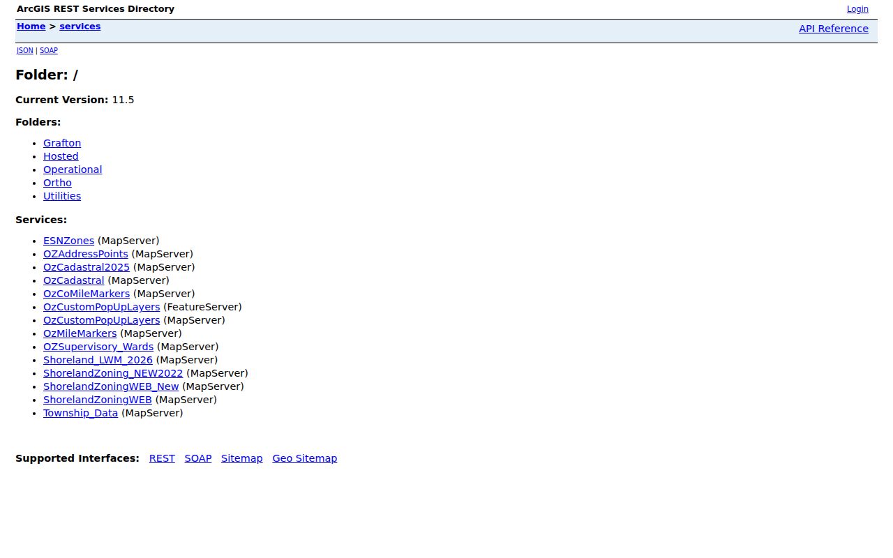
Layer names and dates vary. Save the service name, capture date, selected layers, and disclaimer with any Mequon block map.
Map Mequon Neighbors Outward
Keep the workflow narrow. GeoHub establishes spatial confidence, while the county parcel and deed sources supply record context. A map polygon is not a legal survey. A deed may cover several parcels, and a modern number may not appear in an old instrument. If the street string fails, pivot to parcel ID, plat, CSM, or section, township, and range.
- Find the exact address in GeoHub and confirm the subject parcel. Turn on parcels, roads, and any needed municipal layer.
- Select polygons touching each side, back, and front. Add across-street parcels only when that fits the stated definition.
- Record each parcel ID and situs address, then query it separately in Ozaukee Ascent. Do not assume an owner occupies the land.
- Use the legal description or party name in the Register of Deeds index when a deed or plat is needed.
- Save the map date, layers, scale, aerial year, and disclaimer. Mark every field that remains unconfirmed.
The Mequon street directory follows a whole named road and its longer deed chain. A neighbor search should stop after the defined block or plat has been inspected. That boundary keeps the result focused and cuts needless collection of personal data.
Mequon Neighbor Blocks Across Time
Modern parcels can hide older land patterns. Search the Register of Deeds for a CSM or plat, then compare lot and block numbers with the current parcel layer. Ozaukee County Historical Society holdings include Mequon plat years for 1873, 1892, 1921, 1939, and 1948. Mequon-Thiensville Historical Society and Wisconsin Historical Society references extend the local map trail across 1867 to 1980.
GeoHub documents aerial imagery back to 1941. An aerial can show a field, building, or road at a point in time, but it cannot identify a household. City tax-roll references for 1857 through 1930 and Ozaukee telephone or community directories from 1900 forward can add names. Not every year or complete reverse-directory run has been confirmed.
When a modern street string fails, try the parcel ID, CSM, plat name, and PLSS description. That local pivot is stronger than treating an absent modern address as proof that the land had no earlier household.
Mequon Neighborhood Organizations
Three self-published association sites provide organization-level context. None supplies a public member directory. Use them for news, contacts, and association structure only, and do not copy a private roster into a neighbor list.
Huntington Park HOA
Huntington Park HOA publishes association and contact material. Confirm boundaries in its current documents.
Mequon Park Place HOA
Mequon Park Place HOA provides association news and contacts, not a verified public household roll.
Heron Pond HOA
Heron Pond HOA describes 32 families in 16 units and an elected resident board.
Association membership does not prove occupancy, and a public board role should be described only as the organization states it. Contact the group for its public materials instead of assuming the city keeps a complete neighborhood registry.
Mequon Neighbor Civic Records
Mequon boards and committees and the city's CivicClerk meeting portal add a public civic layer. Agendas and minutes may name a petitioner, applicant, commissioner, or speaker tied to a planning, zoning, landmark, or other public matter. That record proves participation in the meeting context, not residence on the surrounding block.
Search by street, subdivision, agenda item, or organization when the public issue is known. Keep the meeting date, body, agenda item, and stated role. Avoid copying personal contact details from an attachment when the public fact can be explained without them. A request under Wisconsin Public Records Law can go to the city department that holds a permit or retained record when the portal lacks it.
Mequon Neighbors and Voter Data
MyVote's address search can confirm polling place, ballot, election, and absentee information for one entered address. That is useful for checking election geography after a parcel is mapped. It is not a public reverse-address list of every voter on the block. The name route also requires first name, last name, and birth date, and its confirmation flow is designed around the matching voter.
A broader voter-file request goes through the Wisconsin Elections Commission and BADGER process. Available election participation data reaches back to September 2006, with limited older exceptions noted in the county manual, and local updates may follow elections by 30 or 45 days. The file excludes birth dates, driver and DOT identifiers, Social Security numbers, accommodation indicators, and confidential voter names and addresses. Costs and current order terms should be checked with WEC before requesting an extract.
Use voter material only when an election question adds a needed public fact. A polling district can cut through a ZIP or parcel area, and registration can change after a move. A person missing from the file may be unregistered, confidential, outside the search terms, or no longer current. Record “not located in this source” instead of declaring that the person is not a Mequon neighbor.
Mequon Neighbor Tools Compared
Official and commercial sources answer different questions. Commercial neighbor tools may combine public and nonpublic feeds, then merge stale addresses or similar names. An official parcel, deed, plat, or meeting record has a known custodian and a narrower meaning. Neither should be stretched beyond its date and purpose.
| Source Type | Useful Strength | Main Limit |
|---|---|---|
| Official parcel and GIS | Defined parcel, situs, map layers, and source date | Owner does not always equal occupant |
| Recorded deed or plat | Legal party and land description | May be historical or cover several parcels |
| Association or civic record | Public organization and meeting context | No complete household roster |
| Commercial category | Broad lead gathering | Source, date, accuracy, and correction may be unclear |
Use the narrow official claim when accuracy matters. If a record looks wrong, contact Land Information for map data, the Register of Deeds for an index, the city for municipal records, or the association for its own statement.
Note: A Mequon tax owner, deed grantee, ZIP result, or voter record alone does not prove current occupancy.
Protect Mequon Neighbors' Privacy
Wisconsin public records do not create a right to publish every field. Voter extracts exclude dates of birth, driver or DOT identifiers, Social Security numbers, accommodation indicators, and confidential voter names and addresses. Wisconsin Safe at Home allows qualifying participants to use an assigned address and request voter or court-address protection. Utility, delivery, private association, medical, and protected-address details should not be sought or republished as a block directory.
Collect the minimum needed for a lawful question. Cite the public source and date, omit sensitive values, and state whether the item identifies an owner, voter, public meeting participant, or organization. Do not draw a parcel-person map that exposes protected locations or private contacts. A no-result can reflect privacy, retention, an incomplete index, or a search mismatch.
Lawful use. Research Mequon neighbors only for lawful civic, historical, or personal purposes. Never watch, harass, intimidate, or harm anyone.